
Features KC WebGIS
“Information must be available when needed”!
We have taken on this task of our customers.
We are pleased to present you with the KC WebGIS, a more than appealing solution.
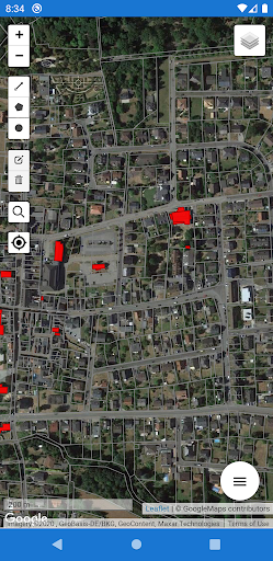
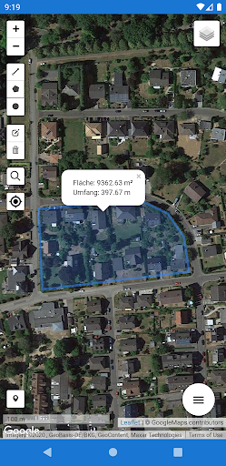
Here is a brief overview of the functions of KC WebGIS:- Mobile use of your GIS and geodata, on and offline on Android, IOS or Windows systems- Recording of point, line and area objects to supplement the existing specialist cadastres (online and offline)- Use GIS as a citizen to display various topics, such as B plans, free building sites, sights, cycling and hiking trails, etc.- Reporting of defects by citizens- Support the fire department: hydrant data for extinguishing water, display 3D building interior images, aerial photos, water and sewer data for backwater and flooding as well as measurement and evaluation functions.- Differentiation of users: Public users can/may only use the freely accessible data/background maps & evaluations.
Event reports are also possible by purchasing the municipalitys deficiency detector.
Official users have full access to GIS and geodata through the municipal license.
Gaming Features
Enjoy immersive gaming experience with various game modes.
Camera Features
Advanced camera features with editing capabilities.
Productivity Tools
Boost your productivity with powerful tools and features.
See the KC WebGIS in Action
Get the App Today
Available for Android 8.0 and above